

The first image presented above is about a part of Stone Harbor that is the thrust of this brief written account. This particular scene looking eastward focuses on one of two lagoons and a group of houses in the foreground that were built in the 1960s that overlook the Great Channel. The large expansive 21 acre area of natural vegetation obviously is the well-known Bird Sanctuary bounded between 111th and 117th Streets.
It seems to this writer that there is one part of Stone Harbor history that has been overlooked, neglected and not given any attention by the mere handful of books published about our celebrated South Jersey seashore resort. Perhaps the southern part of the Seven Mile Island’s most recent stage of development over the past 65+ years has not been depicted on picture post cards as the practice of mailing post cards is no longer a very popular means of communication as it once was years ago. In fact, there are today far more faster electronic options available as the means for vacationers to keep in contact with the folks back home. That being said, it really is a special treat these days to retrieve a U. S. Postal Service delivered picture post card placed in our mailbox. For that matter, when was the last time you personally received a picture post card in the mail?
The area of Stone Harbor I am specifically referring is the part of town beyond 111th Street southward extending to and even now beyond 117th Street all the way to 122nd Street. Also, another area we seem to know so very little about are those man-made or dredged lagoons west of the Bird Sanctuary along Ocean Drive or Third Avenue that were created in the latter 1950s, 60s and 70s and overlook the bay.
Accordingly, and with very little information to go on, I have decided to share with you a few interesting aerial photographs from the Stone Harbor Museum archives that depict the aforementioned areas that were most created or built sometime in the last 65 years or so. That being my focus, here’s where we start.
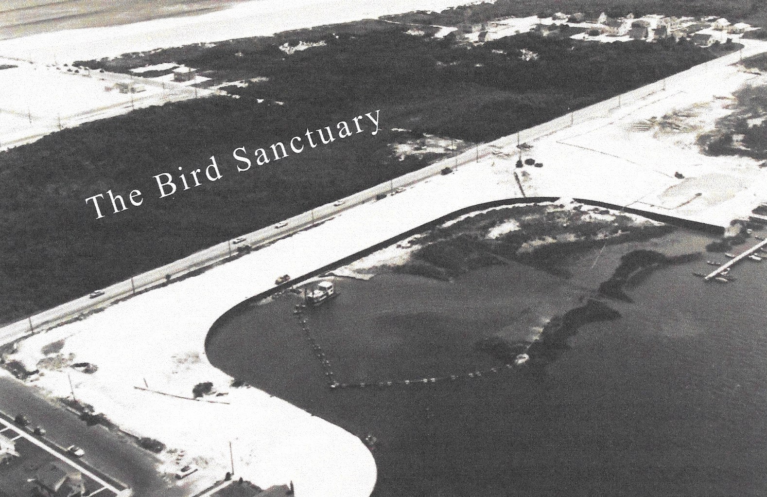
The first of these 3 aerial photographs probably dated about the late 1950s depicts the early dredging process that is creating what is known as Sanctuary Bay. A dredge shown here is already fast at work. Also a permanent bulkhead has already been installed and put in place to prevent soil erosion as well as contain and protect the bay-front property. Please notice that 111th Street is just barely visible in the extreme lower left corner of this black and white image. Preparations are being made to prepare the land and make it suitable for future development and the planned new housing construction along Ocean Drive or Third Avenue. This is a relatively quiet area of Stone Harbor as the Bird Sanctuary is quite conspicuous and is so identified in this photo. Electric power lines and poles as you can see now extend southward along Third Avenue to serve the area.
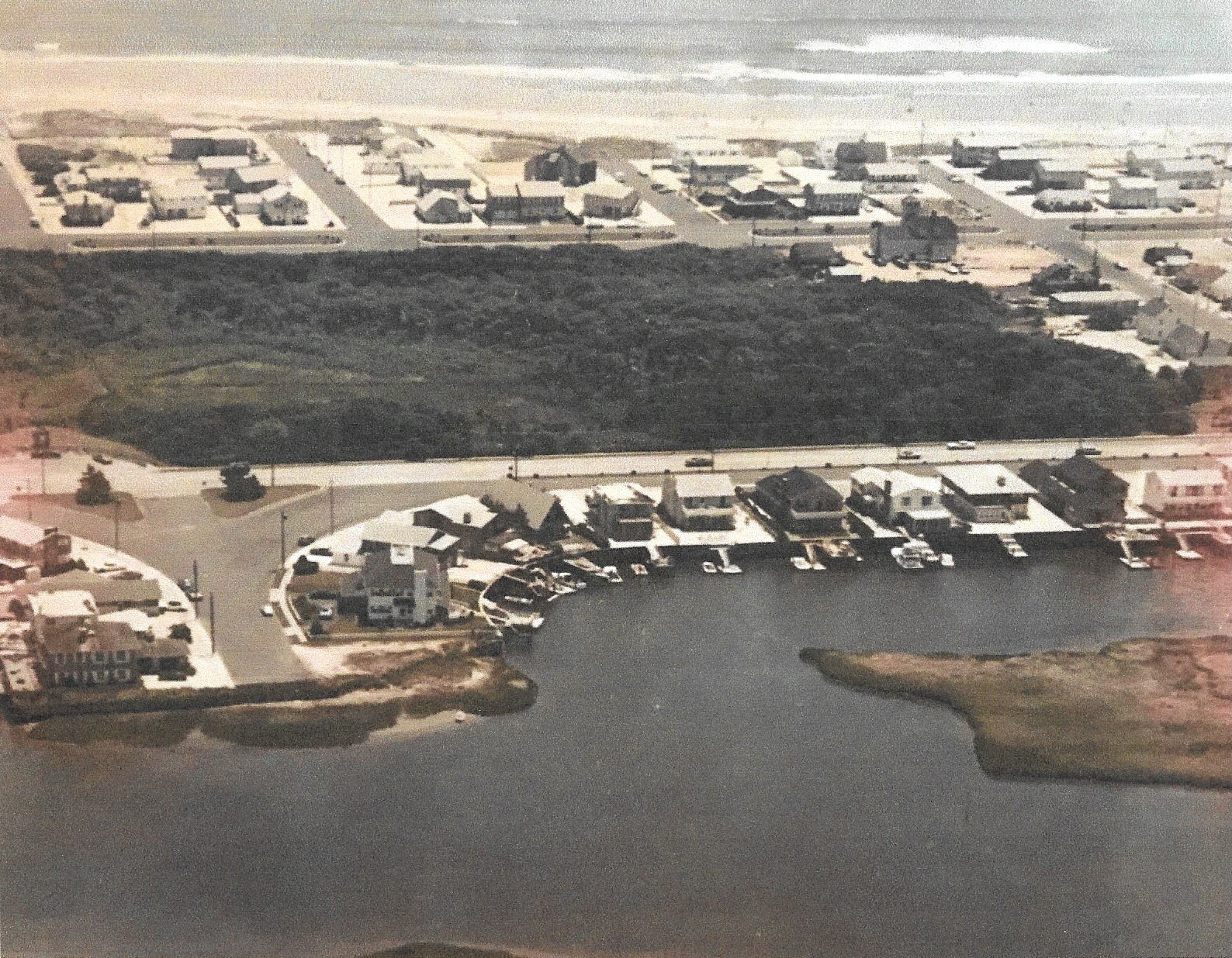
This second aerial photo probably taken around the 1960s another newly developed lagoon Paradise Bay area from 114th to 117th Street. This image is looking east with the Great Channel in the foreground and the ocean in the background. Also evident are the newly completed houses situated along the newly opened Paradise Drive which runs parallel or alongside of Third Avenue/Ocean Drive. The Bird Sanctuary is the dominant area showing the natural vegetation and greenery. You should also be able to locate the Coast Guard Station at the corner of Second Avenue and 117th Street.
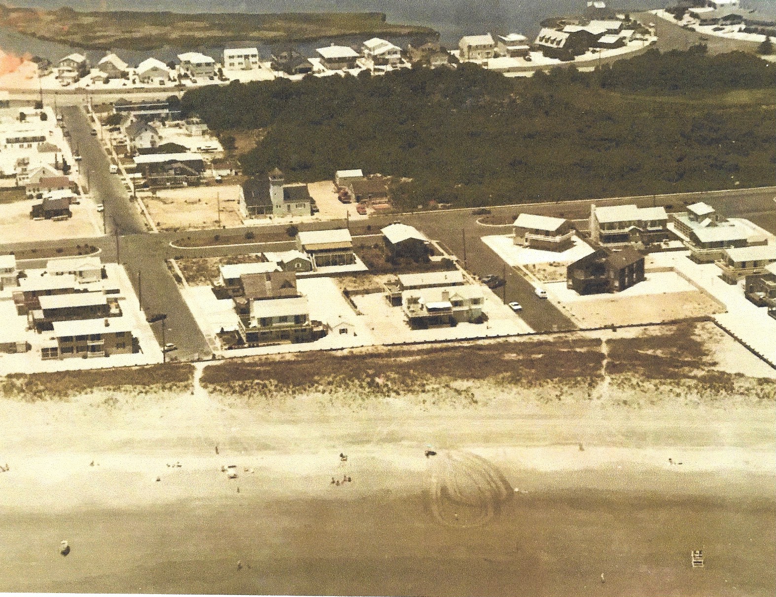
This final image is similar to the previous photo only we are looking to the west with the ocean and beach in the foreground, the Bird Sanctuary in the middle and the lagoon with new housing and the Great Channel in the background. We can observe 117th Street running East-West to the far left and Second and Third Avenues running in a North-South direction across this scene. Once more, we can see the old Coast Guard Station on the fringe of the Bird Sanctuary near left center.
AFTERTHOUGHT: In recent years, and in particular since the early 1980s, the supercharged or heated housing market has been transforming towns like Stone Harbor for example with a continuous churn and rate of change of new housing construction on smallish or confined lots which in turn seems to inflate the size and prices of many Stone Harbor homes. It could be said that this process is responsible for replacing our nostalgic, memory-laden South Jersey Shore cottages of yesteryear that so many of us older folks remember with the so called extravagant and outsized “McMansions” (luxury homes) that today are twice as expensive as some of the priciest homes found on Philadelphia’s Main Line.